
17 of the Most Iconic Hikes Breckenridge, Colorado Offers
This page contains affiliate links. If you make a purchase via a link on this page, we make a small commission at absolutely no extra charge to you. Thank you for your support of this small women-led business!
VIew from Ptarmigan Trail
Unlock Nature's Wonders: Must-Try Hikes Breckenridge, Colorado Edition
Free Gondola Ride to Peak 8 Epic Discovery
Summer in Breckenridge attracts locals and tourists with wildflower hikes, alpine mountain treks, numerous mountain biking trails, fly fishing on the Blue River and water sports on nearby Dillon Reservoir. Throw in ATV escapades and horseback riding through the 2.3 million acres of White River National Forest, plus off road jeeping and you got one heck of a well rounded Colorado summer vacation.
Only a 90 minute drive from Denver through the glorious Boreas Pass, Breckenridge is the perfect home base for your Colorado summer vacation. With Colorado hiking trails in town and others minutes from city limits, you can be up and out hiking early to catch calm summer mornings or stay out late to watch spectacular sunsets.
For Melody’s family, Breckenridge is synonymous with summer. Since her kids were babies, they’ve spent each summer exploring trails in Summit County, tackling Breckenridge elevation on alpine hikes and checking off an endless list of things to do in Breckenridge.
Over the years they’ve amassed a family vacation vault of hikes. For all the local intel on how to successfully take on hiking Breckenridge, Colorado trails and uncovering the magic of this quaint mountain town, keep reading!
These 17 impressive hikes in Breckenridge and nearby Eagles Nest Wilderness are summer trails to come back to over and over again- they are just that stunning!
The Colorado Trail is one of the best hikes Breckenridge, Colorado has nearby.
Don’t let the Breckenridge elevation of 9,600 feet keep you from exploring. Load up on electrolytes, ease up on alcohol consumption, wear layers for that turn on the dime weather and get plenty of rest. Preparation and planning goes a long way in making your summer in Breckenridge a favorite place to visit.
Let’s dive into our favorite hikes in Breckenridge. If you’re new to this area, jump to the end of this post for where to stay, what to do in Breckenridge, local brewery and restaurant recommendations and unique adventure opportunities. Dog sledding and biking over a mountain pass? Yes please!

Reservations Needed
Hiking Reservation Alert
Everyone wants to hike Colorado trails. More people means more trash and trail impact. To keep Colorado beautiful, trail permits and parking reservations are becoming a normal part of popular trail management.
Before you head out, check and know where to park and what you need.
LOCAL TIP! We love the Osprey’s Packfinder tool - they make some of the world’s best daypacks and overnight backpacks, in our combined 50+ years of hiking and backpacking experience. Tackling hikes Breckenridge Colorado style means carrying layers, snacks and water!
Table of Contents
Best Time for Hiking in Breckenridge
Easy Hikes
Trollstigen Trail
Sallie Barber Trail
Baker’s Tank Trail
Burro Trail
Lily Pad Lake Trail
Lower Sawmill Trail
Moderate Hikes
Little French Gulch Trail
Mount Royal Trail
Mohawk Lakes Trail via Spruce Creek Trail
Peaks Trail
Ptarmigan Trail
Wheeler Lakes Trail
Upper and Lower Crystal Lakes Trail
Willow Lakes via Gore Range Trail
Difficult Hikes
Where to Eat in Breckenridge
Breckenridge Insider Secrets
What to Wear When Hiking in Breckenridge
Where to Stay in Breckenridge
Breck Bike Trails
Things to Do in Breckenridge
Trailhead 411
What’s the Best Time of Year for Hiking in Breckenridge
Columbine Flower
Colorado is picture perfect year round. However, for optimal hiking weather, visit Breckenridge from June to mid-September. Keep in mind July and early August is Colorado wildflower season. While the busiest time for Summit County hiking, vacationing during these months pays off with the most stunning colors of flowers on just about every trail.
The trails are lined with purple Columbines, Colorado’s state flower. Red Indian Painted Brush and Claret Cup Cactus are plentiful on many of the hikes near Breckenridge. Get your camera out and snap away but keep the flowers where you found them so the next hiker can enjoy the beauty.
Breckenridge Hiking Insider Secret!
You won’t be the only one enjoying Breckenridge’s summer delights. Colorado locals and out of state guests love this little mountain town. Trails get busy quickly so here’s our insider tip.
Plan your hike starts early. We usually head out between 5-5:30 am. While you might need that extra shot of coffee to get moving, it’s worth it for the quiet trails, ample parking, stunning morning sounds and oftentimes, animal spotting.
Easy Hikes in Breckenridge
Easy is a relative term when it comes to altitude. Breckenridge sits at 9,600’ with most hikes starting well over that elevation. These trails are light in miles, low in elevation gain and easy to access from main roads. They are perfect for families and hikers of all levels.
However, if you are coming from sea level, read up on beginners hiking tips. Sunscreen and hydration are your secret weapons! We always have a hydration pack with us. It keeps our hands free to use trekking poles and gives easy access to water throughout a Colorado hike.
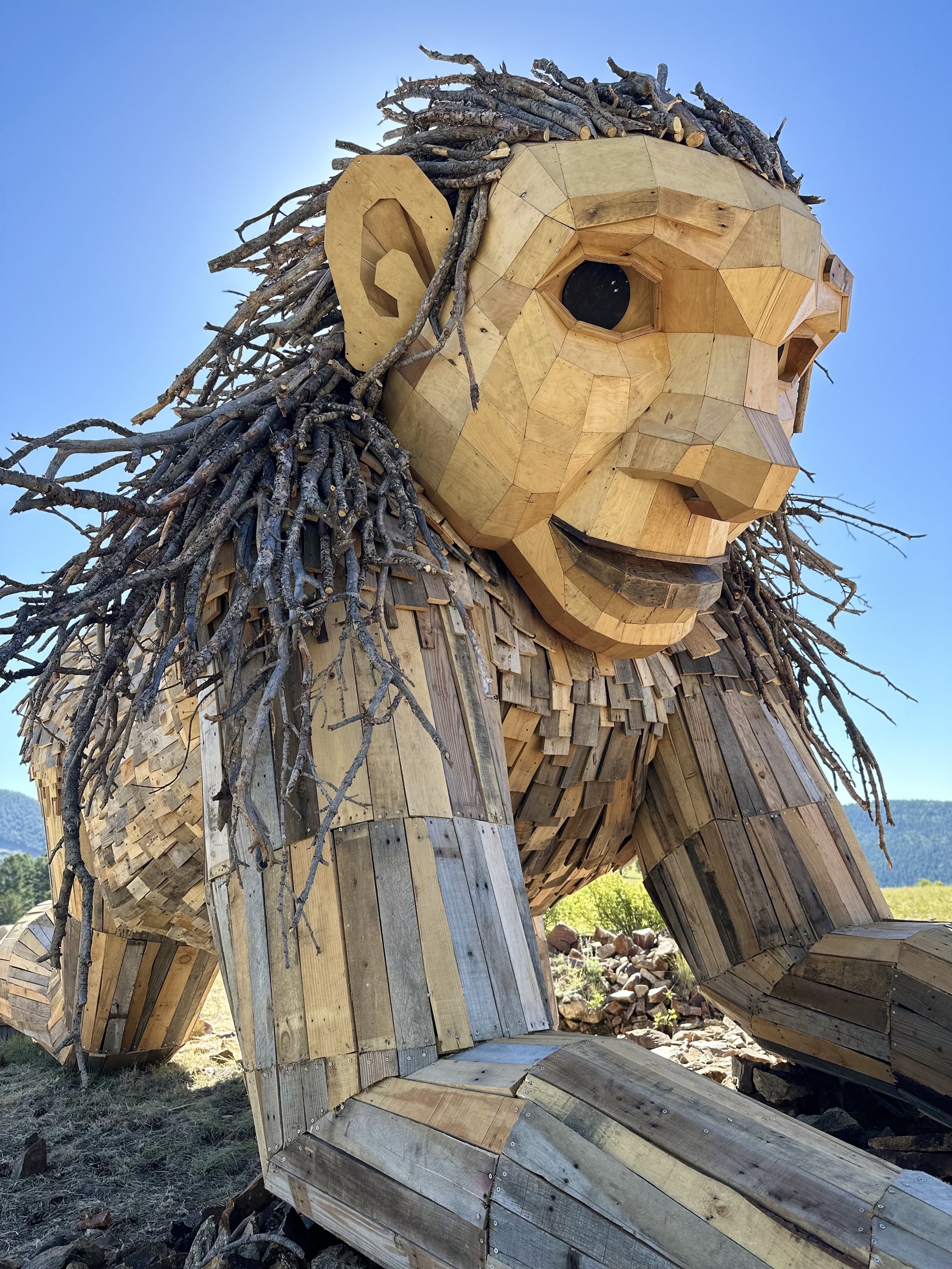
Isak Heartstone
Trollstigen Trail
Mileage: 1 mile Elevation Gain: 121’ Route: Loop
Isak Heartstone, the Breckenridge Troll
Technically more like a city stroll versus a hike, we had to start with a visit to the iconic Breckenridge Troll. Fifteen foot Isak Heartstone is the work of Danish artist Thomas Dambo. Using recycled materials to create this one of a kind work of art, people come from all over to take a picture with the troll.
Plan a visit to Isak, nestled in the woods on the Trollstigen Trail on day one of your Breckenridge vacation. He’s a popular fella so if you’d like to get some one on one time with Isak, get there EARLY.
It’s a well marked trail, easy for all ages to explore and hike.
How to Get There: The trailhead is located in the southeast corner of the Stephen C. West Ice Arena parking lot, next to Illinois Gulch Trailhead.
Insider Secret! There are several marked and social trails around Mr. Heartstone. Take a risk and explore. You’ll find your way back to the parking lot eventually. All who wander here are not lost - you’re in city limits.
Rita the Rock Planter Troll Victor, Colorado
PSSTT!!! ISaac has a new friend
Isaac has a nearby relative! In the summer of 2023, Danish Troll sculpture Dambo created Rita the Rock Planter. Residing on an old mine property, the Victor troll is just as large and in charge as Isaac. About a 75 minute drive from Colorado Springs, make a stop to see Isaac’s newest family member!
Victor Troll Location:
Coming from Colorado Springs, follow CO-67S towards Cripple Creek. About five minutes beyond Cripple Creek, a sharp right turn onto CO Rd 87, a wide dirt road. Many choose to park at the foot of the hill, just off the paved road, and embark on a leisurely hike upwards. This will add incline and about 3/4 mile to an otherwise easy hike
Sally Barber Mine Ruins
Sallie Barber Mine Trail
Length: 2.8 miles Elevation gain: 393’ Route: Out and Back
This easy, relatively flat, 2.8 mile family friendly hike is perfect for the history buff. Heck, it’s just about perfect for anyone. You’ll start on a wide gravel road, heading uphill with some steep stretches. Most of the hike is along a well shaded trail, ending at impressive mining ruins.
While you’ll be distracted by the stunning mountain views, take a minute to get that quick history lesson in, reading the placards around the ruins.
This mine was founded in 1880 by group of Bald Mountain miners. The largest mine shaft is 365 feet deep! That’s a whole lot of digging and dumping.
The area is one of only a handful of well preserved sites in the area for safe exploration. In other words, don’t fret, you won’t accidentally end up 300 feet underground.
The Wandering Five gives a step by step guide to the trail, pictures included. It’s an awesome summary of what you’ll see on this trail.
Sallie Barber is a simple out and back hike. For more all day fun, bring your favorite backpack loaded with snacks and take one of the many backcountry trails that connect to Sallie Barber Mine. (There is a well marked sign at the ruins with these additional trails. Take a picture and get hiking!)
Hiking Breckenridge, Colorado Insider Secret!
A favorite route from Sallie Barber: Sallie Barber -> Nightmare on Baldy -> True Romance trails (almost 6 miles roundtrip)
How to Get There: Take Wellington Road in Breckenridge east to Hwy 2/French Gulch Road. Around the 3-mile point, the Sally Barber Mine Trailhead will be on your right. Note! You’ll need to walk a bit down the road to the actual trailhead.
This is a great Breckenridge winter trail for snowshoeing and cross-country skiing.
Baker’s Tank Trail
Mileage: 6 miles Elevation Gain: 880’ Route: Out and Back
Bookmark this trail for fall!
Most of Baker’s Tank Trail’s 6 miles are lined with aspens, glowing golden in autumn. A single track trail in the well shaded forest makes this a great summer hike.
The first mile or so is relatively rocky and steep. Consider the steady altitude gain this first part, particularly if you are coming from sea level.
Baker’s Tank
Secret Tip! Even those of us who have lived here for years feel the effects of altitude. SLOW DOWN. Drink water. Take breaks. Eating gummy bears and pretzels (salt and sweet) help.
The last 1/2 mile is on a mostly dirt road in the sun. Stick it out. You got this!
Aside from some wildflower spotting and views of Tenmile Range and Quandary Peak, you’ll come face to face with history - the red Baker’s Tank.
During 19th/early 20th century, steam locomotives stopped at this tank to fill their water reserves before heading up the steep grades and curves of Rocky Mountains.
NOTE! Mountain bikers love this trail. Be on the lookout. To avoid them, try hiking weekdays and early mornings.
How to Get There: Parking is a small pullout on the uphill side of Boreas Pass road on edge of neighborhood.
Want to Keep Exploring? Start on the South Illinois Creek trail from Breckenridge skating rink, continuing on to the Aspen Alley Trail and then Baker’s Tank Trail.
Burro Trail
Burro Trail
Length: 6.1 miles Elevation Gain: 918’ Route: Out and Back
This trail is an easy walk from lodging options along Village Road in Breckenridge. It starts at the base of Peak 9 near the Quicksilver chairlift. The trail itself follows a creek creating a cool breeze, ample shade and plenty of places for kids to stop and dance in the water.
This was the first hike Melody’s family took in Breckenridge when her now adult daughter was just a baby. So close to town, it’s easy to hop on after dinner for a cool mountain air walk.
Around a 1/2 mile or so from the end of the trail, you’ll see large mountains of rocks including unique cairns made by hikers and bikers.
This Breckenridge hike ends at Spruce Creek Road.
Cairns at the end of Burro Trail
Hiking Breckenridge, Colorado Local Tip!
Burro Trail connects to Lower Crystal Lake Trail. Plan enough time, pack supplies and layers and make a trek to Crystal Lake.
How to Get There: Park near Beaver Run Resort and Conference Center. At foot of chair lift, trailhead will be towards your left. Look for wood sign. You’ll cross a small stream and head into the forest. (around 5 minute walk)
Trail to LIly Pad Lake
Lily Pad Lake via Meadow Creek Trail
Mileage: 3.1 miles Elevation Gain: 757’ Route: Out and Back
A few years ago our Texas relatives spent a week in Breckenridge with us. There was no complaining as we hiked through the enchanted pine forest, wildflowers on either side. It was not until the goldfish came out and the chipmunks descended that chaos ensued.
While we eventually gained order in our little hiking group, we learned a valuable lesson that day. When hiking with little ones, keep snack time in one place with an adult close by.
This hike is synonymous with beavers. Those little guys have worked hard, creating the best dams and ponds. Much of the hike is in aspen groves making it one stellar fall hike!

Trail to Lily Pad Lake
In our opinion, the first pond is better than the second. As the name says, lily pads cover lake two, creating some spectacular bug slapping activities if you forgot to slather on protection.
Insider Secret for hiking trails Breckenridge, Colorado!
Make sure you go to the far side of the pond and below the beaver dam. The view over the lake and mountain is beautiful.
If you take the Colorado Trail and then turn right at the dirt road, you will meet up with the original trail. You can make a nice 6 mile hike out of it, and the Colorado trail is quite scenic. Mount Elbert is right behind you.
How to Get There: Take Highway 6 toward Silverthorne, exiting on Stephens Way. Turn left on Wildernest Road, then left onto Ryan Gulch Road. Follow Ryan Gulch Road all the way to the trail head.

Sawmill Lake
Lower Sawmill and Snowflake Trailhead
Mileage: 1.5 miles Elevation Gain: 246’ Route: Loop
When our kids were little, this was a favorite evening hike. Packed with post dinner dessert treats and bathed in bug spray (yes, even at 10,000 feet those little buggers like to hang out near bodies of water) we’d set out on this short, easy trail to an alpine lake covered in lily pads.
If you’re coming from sea level, add Sawmill Trail to day 1 or 2 of altitude acclimation hikes.
The first half is an uphill shaded walk. Depending on time of year, you might have a small swamp crossing covered by branches. Keep an eye out!
How to Get There: Take S Park Ave Southbound (Hwy 9) to Four o’clock Road. Turn right on Four O’clock Road and the trail head will be on your left. (Snowflake chair lift at Four O’Clock Road and Kings Crown Road)
Lower Crystal Lake
Moderate Hikes in Breckenridge
Moderate when referring to hikes in Breckenridge usually implies varying elevation gains. Some of these hikes start around 12,000 feet while others start lower but quickly gain in elevation.
The trails tend to be rocky so hiking shoes are a must. If this is your first Colorado hiking trail rodeo, spend some time reading up on the best hiking shoes, runners or boots.
It’s not so much about breaking in your shoes as it is breaking in your feet. Before you take your brand new kicks on the trail, do a few test walks with them.
Oh, and socks! Yep, something so small can make or break your hike. Trust us, we know!
Stick around here enough and you’ll know the ONLY socks we bellow from the rooftops are Smartwool socks. You can pick how thick or high you want them. For moderate to difficult hiking on Colorado trails, consider getting a pair that covers your ankles.
While we can’t guarantee your feet will stay dry, Smartwool will help keep them warm no matter what storm or stream you get soaked in.
Little French Gulch Trail
Mileage: 4.6 miles Elevation Gain: 482’ Route: Out and Back
This trail starts in Lincoln at the end of French Gulch Road and heads toward Mount Guyot. A magical creek winds alongside the trail, cooling you off throughout the journey.
The first two miles or so of the trail are on a wide gravel road. Then the trail narrows and takes you to the gulch. This is one of our favorite Breckenridge summer wildflower hikes! Reds, yellows, purples and pinks dot the trail and meadow, showering you with fragrant whiffs of nature’s perfume. Ahhh..
Keep following the trail leading you through French pass and then head toward Black Powder Pass.

Little French Gulch Trail
Insider Secret for the best Breckenridge hike!
For another option, around mile 1 of your hike, turn left onto viewpoint trail #970A. You’ll have an extra 400 vertical feet of climb to catch some amazing views including Applegate Lake.
The day we hiked this, it was extremely windy. While the trail is marked, spots are hard to find. We ended up adding an additional 600 feet to our climb losing the trail. However, if there was any place to get lost, this is it!
The All Trails map for this trail is only partially correct. Little French Gulch is a trail that branches to the left off of French Creek trail after about a mile. French Creek trail starts as the main road and after passing houses, a mine, and crossing a creek into National Forest, it begins to narrow and climb steeply through the treeline.
How to Get There and Where to Park: You must park at Sallie Barber Trailhead and hike a mile on the road before you get to the trail. Take US 24W and Co0N to Boreas Pass road then drive to French Gulch Road.
Summit of Mount Royal
Mount Royal
Mileage: 3.9 miles Elevation Gain: 1,374 feet Route: Out and Back
We found this hike in the summer of 2020. Desperate for new scenery, we were ready to tackle steep hills for amazing views. This hike delivers on both. Unlike many hikes in the area, there is ample parking at the trailhead.
Prepare for a steady uphill over rocky terrain. You’ll get passed by trail runners. Yes, it’s humbling. GIve them a shout out - what amazing lungs!
Good hiking shoes and trekking poles for the every day hiker are a must. The final push to summit is very steep. However, this is a well marked trail lined with aspen trees. We can’t wait to go back in the fall for all that golden aspen leaf peeping.
Insider Secret!
Once you’ve caught your breath at the top, continue about ¼ mile downhill from the summit to get overlook views of Frisco, Dillon reservoir and fourteeners, Greys and Torreys Peaks.
How to Get There: Take I 70 w. to exit 201. Drive to Frisco. Left on W Main. Right on 2nd cross street onto Forest Drive. Turn Left. TH there.
Lower Mohawk Lake
Mohawk Lakes – Upper and Lower via Spruce Creek Trail
Mileage: 8.4 miles Elevation Gain: 2,106’ Route: Out and Back
As one of the area’s most popular trails, plan to go early if you want to get a parking spot. Parking is very limited. If you don’t get a spot, move on. Parking on the side streets is prohibited. (However, as of June 2022, we saw dozens of cars parked along the road with no sides of tickets.)
Trail to Upper Mohawk Lakes - several more lakes are beyond this point
We did this hike years ago when our kids were little but haven’t been back since. Our 60 year old grandmother came on the hike. Aside from an encounter with a bush that resulted in a small fall (no one was hurt), we had a fantastic time. Our youngest, at that time, was around 2 and Melody carried her in a backpack the entire way.
Unfortunately that hike predated iphones so the photos were terrible. Our kids have voted it’s a must do again and on the list for 2022 hikes in Breckenridge.
UPDATE: We hiked this June 2022. Started out around 8 am on a Monday morning with only a few people parked near us in the large lot. As we headed back later that morning, we ran into dozens of people.
Upper Mohawk Lake
Mayflower Lake is a quick hike for most. The perfect place to stop, take a few pictures, grab a snack and maybe even get a quick nap in before heading to Mohawk lakes.
The snowpack was almost all melted between the Upper and Lower Lakes. That said, trekking poles and hiking shoes kept us from slipping down the bits of snow still clinging to the rock.
Pack extra snacks and make the effort to get to the Upper lake. It’s truly spectacular with alpine blue green water and icebergs still floating on portions of the lake. Several wildflowers had already made their appearance, creating color along most of the hike.
Continental Falls
On our way down the trail, we ran into a few hikers confounded with the trail. They were quite upset about the extra steps they took because the trail isn’t well marked. We shared the correct trail with them. However, it’s a good reminder that downloading maps helps prevent frustration.
I brought our new backpacking water filters to test; the Epic Water Filter and the Katadyn BeFree. Both worked great and the water, as expected, was pristine and ice cold refreshing.
From the parking lot, take Spruce Creek Trail and follow the creek. Plan on wearing a good pair of hiking shoes, taking frequent breaks and fortifying with fun snacks. It’s a steady uphill elevation gain trek. Around 1.5 miles, you’ll come to a junction for Wheeler Trail, which leads to McCullough Gulch Road. Continue straight to get to the Mohawk Lakes Trail.
Look for the Continental Falls about halfway through the hike. We found a trail heading up alongside the falls. It’s very steep. If you have children with you or are in running shoes, stick to the Mohawk trail.
You’ll end at Lower Mohawk Lake with views of Mt. Helen. Lower Mohawk Lake sits at 11,810’.
Note for hikes Breckenridge, Colorado! Most of trail’s elevation comes after the falls – So grab that snack and hydrate before heading up.
How to Get There: Take Hwy 9 southbound and turn right onto Spruce creek Road (Landmark: Grand Moose Lodge) Follow Spruce Creek Road to end. You’ll see the trailhead.
Mayflower Lake
Insider Secret (Freebie Hike): Mayflower Lake
Mileage: 7.9 miles Elevation Gain: 1,922’ Route: Out and Back
The most popular hike from this trailhead is Mayflower Lakes. You’ll get a lovely view of the lake and then join Spruce Creek Trail just before Continental Falls.) An out and back 5 mile hike, this is a perfect solution if a lot of whining ensues. (Oh, that just happens in my family? ha ha)
Continental Falls is a two tiered waterfall stemming from a stream out of Mohawk Lakes. The falls are 2.6 miles from Spruce Creek Trailhead. You can follow the falls as long as you want. Keep trekking for another 1/2 mile and you’ll arrive at Mohawk Lakes.
Both trails are heavily trafficked year round, ranked as one of the top snowshoeing trails in Breckenridge.
Permitted camping and fishing allowed.
Along Peak’s Trail from Frisco to Breckenridge
Peak’s Trail
Mileage: 6.9 miles Elevation Gain: 1,735 feet Route: Point to Point
Note! This hike takes you between Breckenridge to Frisco. We usually hike to Frisco, taking the free shuttle back to Breckenridge.
Dogs can be off leash. This is a shared trail with mountain bikes. While bikes are supposed to yield to hikers, sometimes it’s easier for the hiker to step aside. Colorado hiking trail etiquette is important to know and practice.
Peak’s Trail is mostly on a single track, following Miner’s Creek. You have views of Rainbow Lake. Lots of families hike to and from Rainbow Lake so expect company on this part of the trail. In the fall, hike the 2 miles around Rainbow Lake for leaf peeping and aspen viewing.
At the junction of Peaks Trail and Miners Creek Road, stay on Peaks Trail. (Phone service is spotty at best. It’s helpful to download your map to stay on the right trail.)
In July and August, the open meadow areas are filled with wildflowers. The end is in sight once you cross over Cucumber Creek Road, an unmarked jeep road.
Take the free Summit County shuttle back to town.
Note! About 1/3 of this Breckenridge hike is done on the Colorado Trail, giving great view of Peaks 1-4 through fallen trees. It is a very gradual uphill from Frisco to Breckenridge. Breckenridge to Frisco gives you great views looking towards Frisco.

Insider Secret for this Breckenridge hiking trail!
For an all day adventure, hike to Breckenridge. Take the free Gondola from the summit to Breckenridge. Have lunch, and catch a ride back up the gondola to resume your 15 mile hike back to Frisco. Or vice versa. Frisco has some great restaurants as well.
How to Get There: Trailhead is just off Ski Hill Road in Breckenridge, CO. Use AllTrails link to map you to the exact location.
Ptarmigan Trail
Ptarmigan Trail
Mileage: 5 miles Elevation Gain: 1,141’ Route: Out and Back
This hike has it all! Wildflowers, lakes, mountain vistas, well marked trail - perfect for families. While there are some burn scar areas, the trail meanders through aspen and conifers with views the entire way.
For the first 20-30 min, around 3/4 of a mile, expect a steep trek. Starting at just over 9,000 feet elevation, wear sunscreen and a hat as most of the trail is exposed.
VIsta views from Ptarmigan Trail
Stop and look around as you’ll have views of Dillon Reservoir. The second part of the trail is through aspens and pine trees. The trail takes a gradual climb after the first steep part.
Plan a snack or lunch break around the 2.5 mile point. You’ll want to sit and soak in the amazing vista views. If you follow the AllTrails map, this is your turnaround point.
How to Get There: CO-9N/Blue River Pkwy in Silverthorne. Take exit 205 from I 70 W. Drive to Ptarmigan Trail (turn right)
Note! Parking fills quickly so in this case, the early bird gets the views. You can park on the street.
Wheeler Lake
Wheeler Lakes
Mileage: 6.6 miles Elevation Gain: 1,486’ Route: Out and Back
Located in Eagles Nest Wilderness, this hike promises views, solitude, shade and summer wildflower beauty. However, you will share the trail with flies so bring the bug spray.
The first mile of the hike parallels I 70. Yes, that’s not ideal but is worth it once you turn into the woods.
They’ll be aspen groves and meadows before you reach the alpine lakes. Expect an intense climb uphill right after you enter the woods. You’ll climb for around 2 miles until you reach a couple nice clearings with mountain views. In comparison, this trail is not as steep as nearby Mount Royal.
We loved the spurs off the trails, meandering around lakes. Watch for fallen trees and beaver activity.
How to Get There: Take I 70. You must park at the scenic area before the trailhead that is between exits 195 and 198. This adds about 1.5 miles to hike. All Trails will get you to the exact trailhead location.

Upper and Lower Crystal Lake
Mileage 4.6 miles Elevation: 1,601’ Route: Out and Back
A Monberg family favorite, this hike requires a solid snack bag and lots of water. A relatively short hike in mileage, don’t be fooled! You’ll be hiking almost 2,000 feet in elevation by the time you get to Upper Crystal Lake.
Crystal Lake Trail
A late start, particularly on a Colorado summer day usually means a rainstorm. The day Melody and her husband hiked it, they got caught in a monsoon. Fast and furious with thunder and lightning, it was a dash for scrub oak cover while assuming the lightning position.
Secret Tip! Do you know what to do if you get caught outdoors in a lightning storm? The Clymb has 8 steps for surviving a lightning storm. With a little bit of foreknowledge, you’ll know to assume “the position” (Crouch down low onto the balls of your feet, with your feet close together).
After the storm passed, the sun came out and showed off the views of Mount Helen, Crystal Peak, and Father Dyer Peak. These alpine lakes, in the Tenmile Range, are between east ridgelines of Crystal Peak and Peak 10, just south of Breckenridge.
The first part of the trail is a 4x4 road. You’ll begin your hike above treeline around 12,000 feet. The trailhead is to north side of the lake, then switchbacks across alpine tundra and meadows.
The trail climbs through pine forest, passing above tree line. Upper Crystal Lake is 900 feet higher than Lower Crystal Lake. Eat a good snack and then take the time to head to the Upper Lake. The panoramic views are worth each breath of thin mountain air. Upper Crystal lake sits right under 13,852’ Crystal Peak.
Lower Crystal Lake
Secret Tip for hiking Breckenridge, Colorado trails! For added miles but avoidance of the parking situation, start on Burro Trail. Crystal Lake trail connects to Burro. There are well marked signs so you won’t be led astray.
How to Get There: Take Hwy 9 southbound, turn right onto Spruce Creek Road. Follow Spruce Creek Road to the trailhead at end of street.
Parking: The Parking area is near ruins of old cabin. A 4WD vehicle can make it up to the Spruce Creek Wheeler junction, which cuts almost 2 miles out of the trail loop.
Willow Lakes
Willow Lakes via Gore Range Trail
Mileage: 11.9 miles Elevation Gain: 2,716’ Route: Out and Back
This is a stand out FAVORITE hike. Not convinced? Listen to four kids share their opinion, the youngest, at the time, was 6 years old.
It’s also a great place to backpack and camp. Amazing views throughout the trail, a few alpine lakes, wildflowers and of course, stunning mountains ringing the final lake make this an A+ hike.
A well maintained trail with clear trail signs, even the directionally challenged like Melody are successful navigating this Colorado hiking trail.
Willow Lakes Trail Kids Review
Located in Eagles Nest Wilderness, it’s a bit of a drive from Breckenridge. However, get up early and out, arriving at the trailhead between 7 or 8 am to get a great parking spot and start to your hike. There is a bonus overflow parking lot if you arrive late.
However, if you have the privilege of parking there, add an extra 2 miles to your hike.
Aspen trees dot the first couple of miles, making this a great fall leaf peeping destination. There are plenty of rest areas along the way. Take advantage of the scenic stopping points, particularly after hiking uphill between miles 2 and 4.
While you’re on the trail, take the extra one mile round trip to Salmon Lake. It’s not that far or steep and well worth the effort.
Rest stop along Willow Lakes Trail
Depending on the time of year, you’ll spot mountain goats. Just a reminder - You’re in their home so mind your manners, stay far away, take pictures and hike on.
Insider Secret! For fall viewing, take South Willow trail to Mesa, connecting to North Willow for a complete loop (between 5-6 miles). It’s a bit longer but the aspens are worth the effort we promise.
How to get There: Take CO-9N to Blue River Parkway. Drive to Willowbrook Road. The main parking lot only holds around 12 cars.
Mountain goats on Quandary Peak
Difficult Hikes in Breckenridge
These bad boys are worth your blood, sweat and tears. However, you need to go in eyes wide open, daypack supplied with just in case items and a whole heck of a lot of water. Load up on sunscreen and layers.
Summer in Breckenridge has variable weather. While we’ve been saying this on repeat, it’s important to remember thunderstorms and lightning are just part of Colorado hiking. Start early to avoid these storms.
Bald Mountain Summit
Bald Mountain Trail
Mileage: 10.3 miles Elevation Gain: 3,123’ Route: Out and Back
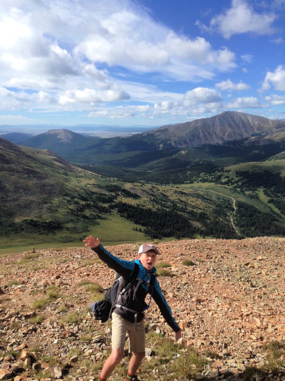
In Melody’s family, each 5th grader does a “Hike with Dad’ right before they start middle school. Her husband, Matt, researches and gives them a few options, allowing each child to pick “the one.” Her son picked famous 13,690’ Mount Baldy, a known 13er with panoramic views of Breckenridge and surrounding mountains.
After winding your way through neighborhoods wondering if this is the right way (yes, it is), arrive early to get parking at the smallish trailhead. It’s about a 1/2 mile beyond the edge of the residential area. While 4WD is not necessary, regular cars will need to mind the road to avoid damage to their car.
The Summit Daily does a great job sharing all the nitty gritty details of driving to the trailhead (it’s tricky in parts!) and the actual trail route.
Keep an eye out for a cabin in the woods on right within first ½ mile of trail. Another 1 mile in and you’ll pass Iowa Mill, built in 1935.
Mount Baldy Trail
At the summit, check out Tenmile Range and Breck to the northwest and Swan Mountain and Dillon Reservoir nearby to the north. There are also great views of Mt Guyot and Boreas Mountain.
The trail is a road, starting in a forest.
How to Get There: Go to Mt Baldy Road, driving past Gold Point Resort. The trailhead is on your left. Rd 520, intersection of Baldy Road and Goldenview Drive, right by Summit State bus stop.
Trail Note: The end of the trail has been closed, claiming private property ownership. However, it’s not well marked where the public trail ends the private property begins.
Insider Secret! Turn a big moment hike like this into a tradition. As your kids get older, come back to the trail and share memories. It’s amazing how walking the same path awakens buried memories, creating food for thought and some fun memory making.
Summit at Quandary Peak
Quandary Peak
Summit Elevation: 14,271 feet
Mileage: 6.6 miles Elevation Gain: 3,326 feet Route: Out and Back
NOTE! As of July 3, 2021, you must have an advanced permit reservation to hike Quandary Peak.
Quandary Peak is the 13th highest peak in Colorado’s famed 53 fourteener club. As the only 14er in Tenmile Range, it’s an extra special hike with views of Mt. Democrat, Cameron, Lincoln, Bross. Crystal Peak and Pacific Peak can be spotted to the north and the Gore Range off in distance.
While the low mileage might make you question the Difficult category of this hike, don’t be fooled. You’ll be climbing 3,500 feet in only 3 miles over exposed rock.
The trail begins north of Hoosier Pass in White River National Forest. Shaded pine trees. A well marked trail takes you into the forest. Regular trail signs mark the trail, providing excellent navigation. Oh, and they’ll be plenty of people to follow as this is one of the most popular 14ers to hike.
There are large families of mountain goats on this peak. Stick to the trail but keep a watch out for these cute and wild animals.
How to Get There: Start on Hwy 9 southbound for around 8.5 miles. Turn right onto McCullough Gulch Road. The trailhead is located on left side of street. Parking lot fills quickly in summer months. Get there early to find a spot.
Quandary Peak Final Push to Summit
Insider Secret for hiking Breckenridge, Colorado elevation hikes!
If 14ers pique your interest, learn how to summit the easiest, and hardest 14,000 foot peaks. These bucket list hikes offer spectacular views and kudos for completing.
McCullough Gulch
McCullough Gulch Trail
Trail Length: 6.4 miles Elevation Gain: 1,607’ Route: Out and Back
NOTE! Effective July 30, 2021 a parking reservation is REQUIRED. See link for parking reservation and shuttle information
Located in the White River National Forest near Quandary Peak trailhead, McCullough Gulch is a difficult Colorado hike. Make sure to get your reservation, pack your daypack, lace up your hiking shoes and grab those trekking poles.
Whew, while that might seem like a lot, the lakes, waterfalls, wildflowers, mountain goats, and mountain views are worth all the work it takes to get here.
As you start, the beginning of the trail follows an old mining road, splitting to White Falls and Upper Blue Reservoir. Choose to add a 1 mile detour to White Falls at the trail marker.
This Colorado trail ranges from rocky to dirt covered. While you’ll be heading up hill throughout the hike, the trail from the first lake to second is difficult and narrow.
Look out for the big boulder field between the two lakes. Be careful the route you take up. Some are complete scree. This is one slip and slide you want to avoid.
Once you pass final the ridge, you can’t miss Pacific Tarn. This high alpine lake sits at 13,868’ and is officially the highest named lake in the USA.
Hike a bit to the left of lake for views of Leadville and Copper.
Note! The trail is not well marked trail through the alpine meadows – keep your map app or paper map handy for own route-finding.
Insider Secret! Bring your fishing license and poles on the trail to the Upper Blue Reservoir. Spend the day fishing. or exploring the upper valley’s 6 more alpine lakes. The trail is on the north side of Quandary. This trail ends at backside of Mayflower Gulch (super popular hike), giving you similar views with much fewer people.
How to Get There: Take Hwy 9 southbound for around 8.5 miles, then turn right onto McCullough Gulch Road. OR Take the shuttle to Quandary lot and another short shuttle to this trail. It’s a ½ mile walk from shuttle to the official trailhead.
Check for Road Closures
Crepe from the Crepe Cart in Downtown Breckenridge
Where to Eat in Breckenridge
Mother Loaded Tavern
From cocktails to favorite Breckenridge breweries finest beers, this is a must stop at least once on your summer trip. While everything on the menu is great, their burgers are home runs.
The Canteen Tap House and Tavern
We were thrilled when this opened a few years ago. With a modern take on the old classics, ahi poke salad for example, this restaurant serves up some of the best sandwiches, soups and salads you could want after a hike in Breckenridge. Cocktails arrive in cute metal canteen cups which you can buy for a take home souvenir.
Sancho
Every taco on this menu is finger lickin’ good. You’ll want to come here several times during your summer in Breckenridge vacation. Vegan, vegetarian and meat options for every palate. Oh, and don’t forget to get the margarita!
Breckenridge Coffee house formerly known as Cool River Coffee
This is the place for breakfast. Stop here before a hike and you won’t need to eat until the day’s end. Pastries, oatmeal, breakfast burritos and coffee to go. Or, snag a table along the river, hunker down and enjoy the rushing water sounds while you sip that latte.
*Lunch is served as well as boozy drinks!
Crépes à la Cart
There is always a line wrapped around the block for this crêpe cart. While you might wait an hour to order, with over 20 options to pick from (sweet, savory or some of both), get in line. You won’t be sorry!
Breckenridge Brewery and Pub
We have to include at least one of Breckenridge breweries on our must visit list. Traditional pub food is served because fries just taste better with a beer right? However, they carry local beers and Colorado famous ales on tap, making it a fun stop.
Insider Secret! There are dozens of amazing places to eat in Breckenridge. We usually pick a few for the week’s vacation and buy groceries for the rest of our meals and snacks. City Market, the mountain version of Kroger, is in Breckenridge for groceries. Downtown Frisco, about a 20 minutes drive from Breckenridge has a Whole Foods and Super Walmart.
Chairlift ride near Epic Discovery Center
Insider Secret Spots
Mountain Top Cookies
Mountain Top Cookies
128 S Main St, Breckenridge, CO 80424
Originally Mary’s Mountain Cookies back in the day, Mountain Top Cookies rival Crumbl with their double stuffed sandwich cookies. Generous in size and flavor, head there early to get the day old buy two, get one free deal. This little cookie shop on main street is near the Welcome Center. Follow the scent of fresh baked cookies. It won’t be hard to find!
Peek A Boo Toy Store
117 South Main Street, Breckenridge, CO 80424
When Melody’s kids were little, they visited this store daily. Not only is it chock full of puzzles, games and toys, they have many interactive centers for kids to try before buying. When that afternoon rain hits, head here.
Epic Discovery
170 Watson Ave, Breckenridge, CO 80424
If you’re looking for things to do in Breckenridge, this adventure park should be on the list. While pricey, there are a few pass options for half day or all day fun.
Often Melody’s family will get the Alpine Slide pass. Teens and tweens love the hair raising mountain slide. Other options include a bounce house, the largest human maze in Colorado, zipline and ropes course for kids as well as restaurants on site.
Insider Secret! Rather than dealing with parking, take the free gondola to and from.
Barney Ford House Museum
111 East Washington Ave, Breckenridge, CO 80424
This small museum just off main street downtown Breckenridge should be on your must do list. Barney Ford escaped slavery in his 20s, eventually finding himself out west to try his hand at mining. While that didn’t go so well, he ended up opening a successful restaurant. Barney Ford was a man of courage, perseverance and integrity, a story well told at this museum.
Breckenridge Recreation Center
880 Airport Road, Breckenridge, CO 80424
Look no further than this 69,000 foot sports and activity center near City Market. You’ll have access to a gym, indoor tennis, lap pool, waterslide, group exercise classes and more. If you’re camping in Breckenridge or nearby campgrounds, use your day pass for a nice long hot shower.
Headed down Quandary Peak Trail
What to Wear
The childhood tune, “Head, Shoulders, Knees and Toes”, comes in handy when planning what to wear for hikes in Breckenridge.
Sunshade is a must. Grab that hat, sunglasses and sunscreen.
Layers are key! Tank tops help with that summer tan. Add a long sleeve sun shirt and windbreaker to your daypack. If you plan on hiking above treeline (10,000 feet), throw in a lightweight jacket like the Patagonia puffer. It’s light on weight but great on warmth.
Alpine deserts get rain too. Summer in Breckenridge means torrential downpours most afternoons. Pack that rain jacket. Wet = Cold -> hypothermia. Avoid that equation.
Go ahead and show off your hard winter workout results with shorts. But bring pants or wear convertible pants for the sudden temperature changes that happen during summer hikes in Summit County.
Happy feet = happy hiker. Wear wool socks. Gaiters also help keep out small stones and gravel..
Related Links:
Climbing 14ers is part of Colorado residency. At least it seems that way when you hear about bagging those peaks. Summit Colorado’s easiest, and hardest 14,000 foot peaks.
Beginners hiking tips are great for newbies vacationing in summer in Breckenridge. Heck, even the Colorado hiking trails expert needs a refresher every so often.
Our favorite hiking and outdoor gear has been tested. Only the best survived in the ultimate outdoorsy gift guide.
Where To Stay in Breckenridge
Cabin and Vacation Home Rentals
From Breckenridge vacation cabins and rentals to hotels and timeshares, you have a lot of choices of where to stay.
Melody’s family makes Snowflake Drive homebase. This area of Breckenridge is within walking distance of their favorite hike in Breckenridge, Burro Trail and about a 1/2 mile from the downtown restaurants and shops.
If rustic mountain cabins are calling your name, consider staying on the outskirts of town, close to more hiking trails and the Blue River.
We are big fans of Breckenridge vacation rentals vs hotel stays. Access to a kitchen and washer and dryer makes late night snacks and clean hiking clothes easy peesy.
Prospector Campground
Campgrounds in Breckenridge and Summit County
Breckenridge, Colorado camping is worth it IF you can secure a campsite. While many of the campgrounds are reservation only, most have a few first come, first serve sites.
SUP from Heaton Bay Campground
Prospector Campground sits above Dillon Reservoir between Keystone and Frisco on Swan Mountain Road. One year Melody’s family lucked out, securing an outer campsite on July 4 weekend, the perfect spot to watch a magnificent fireworks display.
Reservations can be made up to 6 months in advance. From personal experience, they fill within a few hours.
Outer ring Campsites 51-62 have the most shades with trees, larger plots and great Dillon Reservoir views.
RV hookups for some sites. Vault toilets and water taps.
Heaton Bay Campground is a great place to camp especially if early morning water sports are your thing. One year Melody’s family brought their SUP and hammocks. After sleeping overnight among the trees, they took out the SUPs and watched the sunrise on the water. To go coffee included.
Campground can accommodate tents, trailers and RVs.
Walk-in only tent sites available of a first-come, first-served basis.
Equipped with picnic tables, campfire rings, vault toilets, and drinking water
For more campgrounds in Breckenridge and Summit County, check out Planetware’s top 10 list. They do a great job sharing tent and RV camping sites in the area.
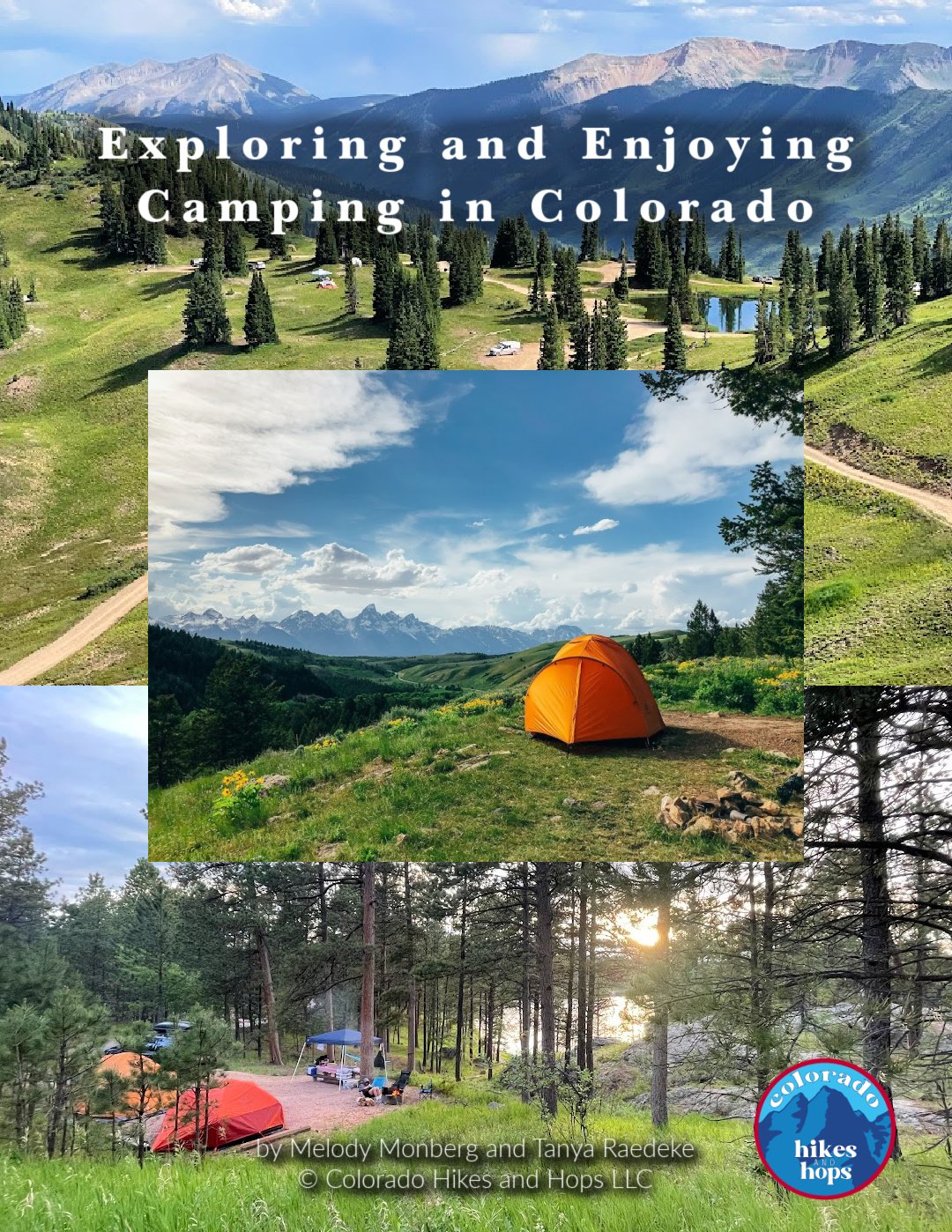
DOWNLOAD THE FULL GUIDE TO CAMPING IN COLORADO (PDF)
Together, we have over 50 years combined camping experience all over the world.
We know camping can be intimidating, especially when it comes to the right gear, finding campsites, cooking over a fire, and making sure everyone's having a blast.
Whether you're a newbie or a seasoned pro, fear not! This detailed ebook is your ultimate guide to Colorado camping. We’re spilling the beans and sharing all our best tips and tricks to make your Colorado camping trip unforgettable.
Our 65 full-page Exploring and Enjoying Camping in Colorado eBook (PDF) covers:
Types of Campgrounds
How to Practice Leave No Trace Principles While Camping (lnt.org/)
How to Book a Campground Online
Tips for Getting Last-Minute Campsites in Colorado
Our Favorite Campgrounds in Colorado
How to Set Up Your Entire Campsite
How to Set Up Your Camp Kitchen
11 Camping Recipes Everyone Loves
Cooking Over a Campfire
Camping Bin Checklists
Personal Camping Pack List
Things to Consider While Off the Grid / In Case of Emergency
And more!
WANT TO RENT A CAMPER VAN?
Not keen on tent-camping but want to get out there all the same?
We’re a fan of booking with Outdoorsy RV Rentals, the #1 Trusted RV Rentals.
Check out these TOP RV RENTALS IN COLORADO.
Save $50 OFF your next Outdoorsy RV Rental using exclusive promo code “COHH50”
Already Own an RV? Wanna make up to $50,000 this next year?
Best side hustle yet! Rent your RV when you’re not using it. Folks are always looking for all kinds of RVs to rent, but especially Class B and Class C RVs.
Breck Bike Trails

Summit County Rec Path near the Dillon Reservoir
Biking in Breckenridge and Nearby Vail and Frisco
While we love to hike, it’s fun to shake things up and hop on a bike. With so many things to do in Breckenridge, Colorado, biking is high on the fun factor list!
Bike rentals are abundant in Breckenridge with options of electric bikes, tandom, bike trailers and trail a bikes.
The Summit County Rec Path has several entrances throughout Breckenridge. Hop on it for a day long adventure or a quick morning loop. Around 20 miles to Frisco, this path is an easy ride with views of Dillon Reservoir along the way.
Vail Pass Rec Path
When especially ambitious, we head up the Vail Pass Rec Path, a 36 mile round trip that begins and ends at the free public parking lot at Frisco Marina (267 Marina Rd, Frisco, CO 80443).
There’s usually a lot of groans on the way up, gaining an impressive 1,831 feet. However, what goes up must come down. Man is that fun!
Related Links
For more bike rides around Vail check out these fantastic trails
Dillon Reservoir
Unique Things to do in Summer in Breckenridge
Breck Summer Dog Sledding
Learn the inner workings of dog sledding, spending time meeting the dogs and sledding behind them. Adventures start at $75/3 hours.
Dillon Reservoir Water Activities
Silver Dollar Island hangs out in this immense man made reservoir, sometimes called Dillon Lake. Built to divert water to Denver from Blue River, Dillon Reservoir provides hours of summer fun. Fishing, paddleboarding, pontoon boating and kayaking are welcome in this water.
Rent a Pontoon Boat at Dillon Reservoir
Whether you are out fishing or just sunning, hop on a boat for a day’s adventure.
SUP (Stand Up Paddle Boards) and Kayaks
When our kids were little, we’d rent one SUP and one kayak. The kids would take turns practicing paddling both. Now teenagers and young adults, they are pros at navigating Dillon Reservoir.
SUP yoga on Lake Dillon
Fly Fishing
The Blue River runs through downtown Breckenridge, offering amateurs and experts fly fishing practice. Make sure to get a sporting license before you hook that fly onto your pole.
Snag a 2 foot Rainbow Trout in the 2 mile stretch of tailwaters of the Blue River below the dam. Or find a private spot on any of the 26 mile shoreline to reel in Brown Trout, Kokanee Salmon and Arctic Char.
Note! If you’re 16 years or older, you can get your license online. For all permit information, Colorado Parks and Wildlife is a great resource.
Stretch and Bend in a Yoga Class
Try out Warrior 2 on your own SUP or consider taking a yoga class in one of Breckenridge’s many yoga studios.
Summer in Breckenridge means fresh crisp mountain air, perfect for those deep cleansing yoga breaths your body craves. The Breckenridge Recreation Center hosts many exercise classes including private lessons. Most of the studios offer drop in classes or punch card options depending on how long your Breckenridge vacation lasts.
Horseback Riding in breckenridge
Saddle up your horses, we got a trail to blaze. Well, not exactly. The trails are well trodden and the horses come to you already ready for an hour or so adventure.
There’s something pretty special about headed through the National Forest on the back of a large beast. While there might be a fair amount of giggling around your well fed and hydrated horse, book a 90 minute ride for this one of a kind memory.
Got Jeep?
We know off roading is tons of fun. Rent an ATV or Jeep and scout out some made just for you roads in and around Breckenridge. There are several companies who offer half day and full day adventures.
Downtown Breckenridge across from the Welcome Center
Getting Around
Renting a car is your best bet for Colorado trail hiking. Ample free parking in the summer in and around Breckenridge makes it easy to head into town for that post hike beer and burger.
Breckenridge free bus shuttle, The Summit Stage, is open year round. With several bus stops throughout Breckenridge and adjacent towns, it’s a great alternative to car rental. The buses have bike racks as well.
Insider Tip! Begin your trip with visit to the Breckenridge Welcome Center for free hiking maps, coupons and special event information. They do a great job sharing trail updates, historical tours and special events in town.
Book tours at beginning of vacation week to ensure you have the times you’d like. We love the Breckenridge Ghastly Ghost tour!
July 4 and Labor Day are big holidays in Breckenridge. From outdoor concerts to duck races down the Blue River, this mountain town packs a punch celebrating. Best of Breck gives you super insider information on concerts, activities and farmer’s markets.
Trailhead 411
According to the AllTrails app, visitors doubled in 2020. Covid got a lot of people outside! A desire for outdoor adventures have increased permit requests for use of National Forest land, overwhelming the limited ranger staffing. Summit County alone draws over 3 million hikers, outdoor enthusiasts, bikers and backpackers annually.
Those numbers are great for overall mental health but create new challenges, from packed out parking lots to backcountry SOS calls.
Avoid this annoying and oftentimes painful experience with preparation.
have a plan and tell others what it is.
Download the trail map on your phone. Have a paper copy just in case.
Insider Tip! Tell people where you’re going and when you’ll be back. Leave a paper copy of the trail on the seat of your car at the trailhead.
If plan a doesn’t work, have a backup.
Note nearby trails in case parking is an obstacle for the ultimate hike you want. Many popular hikes require permits and parking reservations. Track park and peak reservations at least 6 weeks prior to your trip. There are over 300 miles of hiking trails and mountain biking trails in White River National Forest. You have options!
Timing is key
In summer months, most trailhead parking lots are full to overflow by midmorning. Mid afternoons are less crowded but thunderstorms often hit (be prepared). Plan your hikes on weekdays if possible and start early.
Safety First
Bring extra water. We are huge fans of water reservoirs, carrying at least 3 liters with us. If carrying all that water seems too much, check out the Epic Water Filter. This Nalgene water bottle includes a filter and is 100% recyclable allowing you to safely drink mountain water.
Rule of Thumb: Have at least 1 liter water per hiker for every 2 hours on the trail.
Layers, snacks, a basic first aid kit and good shoes are essential for Summit County hikes. Check out these day hike backpack essentials for stress free hikes in Breckenridge.
Check the trail rules
Can I bring my dog? Do I need to pay for parking? What about overnight camping?
You need to know who is allowed on the trails, where they can go and if it costs money. Backcountry camping can be a ton of fun if you follow the rules. Permits may be required and can be reserved in advance at a ranger station. Check all trail regulations.
Leave No Trace
Take a minute and read through what it means to leave no trace when you are hiking in Breckenridge. Look but don’t touch. Taking care of our planet can happen with responsible hiking. These simple and easy steps are easy to practice and do.
Plan Ahead and Prepare
Travel and Camp on Durable Surfaces
Dispose of Waste Properly
Leave What you Find
Minimize Campfire Impacts
Respect Wildlife
Be Considerate of Others
Local Tip! Bring a glove and dog waste disposal bag. As you see garbage, pick it up and carry it out.