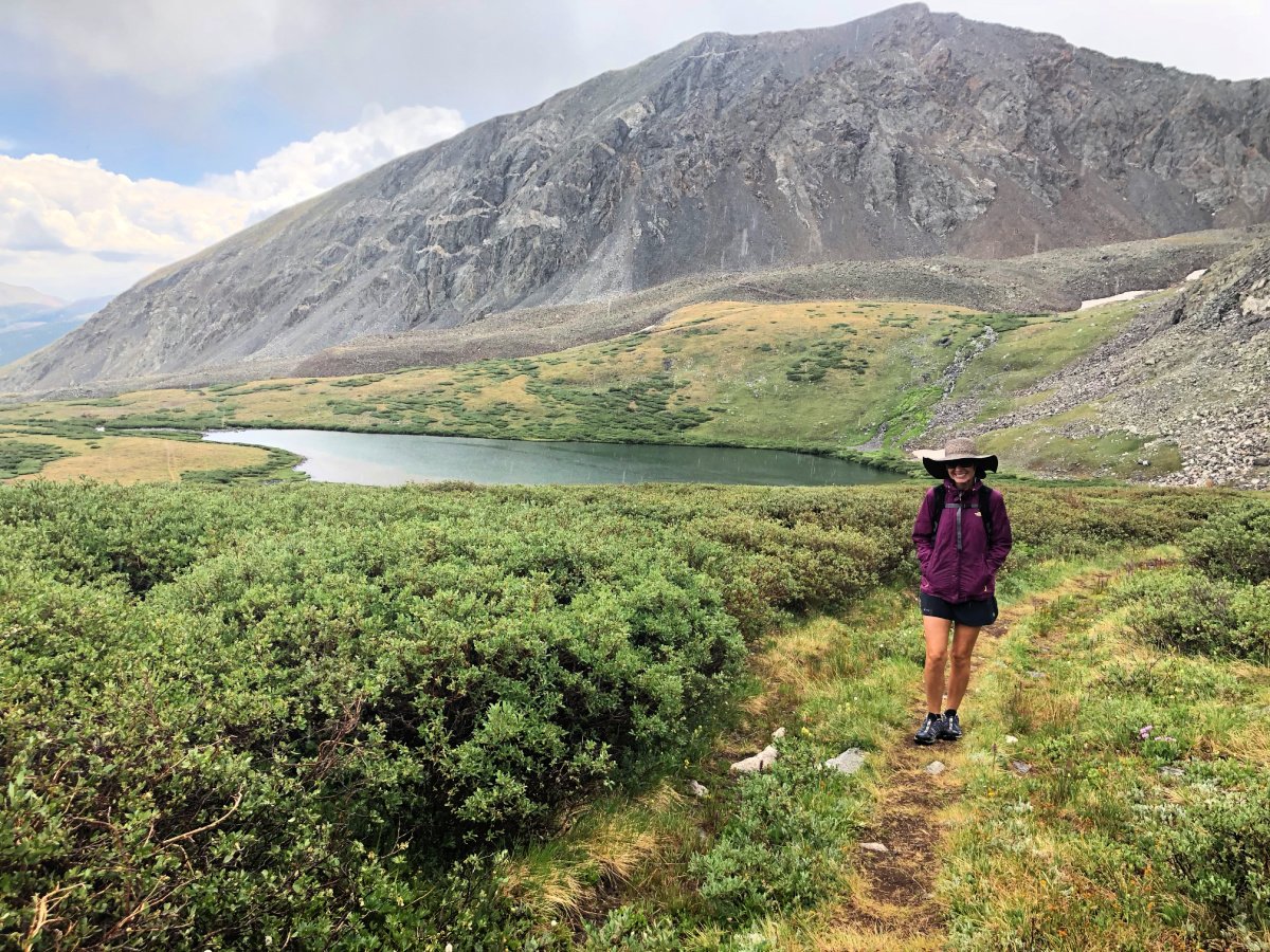
Unmissable Hikes in Colorado: Top 17 Trails to Explore
17 Best Hikes in Colorado for 2025
If you’re looking for the ultimate outdoor adventure, Colorado is one of the best hiking destinations in the US.
From stunning mountain views to challenging terrain and colorful wildlife, the state has some of the most gorgeous trails in the country.
Before we cover our 2025 list of must-do Colorado hiking trails, we’ll first answer some common questions visitors often have.
What is the most scenic hike in Colorado?
Beauty is in the eye of the beholder when it comes to choosing the most scenic hike in Colorado.
And yet the iconic, postcard worthy Maroon Bells will undoubtedly be touted as the best hike in Colorado hikers from all over the world.
The Maroon Bells showcase majestic mountain peaks, lakes, countless wildflowers, and adventurous stream crossings, plus star-studded backcountry overnights.
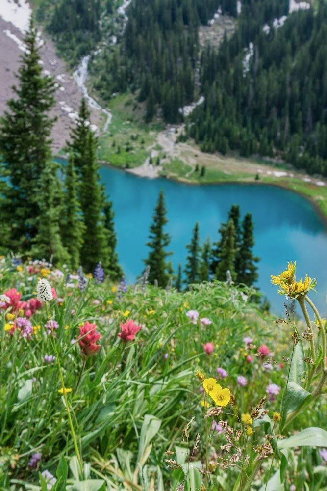
But we also love Zirkel Circle near Steamboat Springs, as well as the Blue Lakes Trail in the San Juan Mountains. Both are our top three of best Colorado day hikes with unmatchable views.
Naturally, our list of favorites includes some with waterfalls, and others with breath-taking vistas, or both!
What city in Colorado has the best hiking?
Do you prefer to stick close to a big city when you are looking for the best Colorado hikes?
We believe hiking in Colorado Springs offers some of the best Colorado hiking trails.
While we’re a tad partial to our own backyard, it’s tough to beat hiking Pikes Peak, through North Cheyenne Canyon, or nearby Palmer Lake.
If you like more remote hikes in national forests, don’t worry. We have slew of hikes for those who love to wander, but not get lost.
Find some of the best Colorado Springs hiking trails in Garden of the Gods and all around Pikes Peak.
What is the best time of year to hike in Colorado?
Most would say summer is the best time of year to hop on the best hikes in Colorado, but winter has it’s advantages too.
We choose summer for wildflowers, waterfalls, and warmer days. But nothing beats winter hiking for those aiming for solitude and snowy wonderlands.
No matter the season, we can help you dress for hiking success. We know what to wear hiking in Colorado.
For 2025, pay attention and read through the entire list below: we’ve added Lake Isabelle and Music Pass to this list of great Colorado hikes.
Zirkel Circle
Gilpin Lake, one of two lakes visited along the Zirkel Circle hike near Steamboat Springs
The Zirkel Circle trail is one of our all-time coolest hikes in Colorado, offering stunning views of the Zirkel Wilderness area and Medicine Bow Peak from its 11-mile loop.
Most people like to hike it counter-clockwise, arriving at Gold Creek Lake first after passing by waterfalls and crossing a bridge. You will follow water a lot of the way to Gold Creek Lake.
After a steeper ascent, you will come to the pass and an amazing view of Gilpin Lake before hiking around the right side.
You will climb 2,444’ on the challenging Mount Zirkel Loop Trail.
Whether you're into quick day hikes or overnight camping, Steamboat Springs has something for everyone. There are plenty more trails to explore around Steamboat Springs, so be sure to get out and explore them all!
Stay in this cozy romantic cabin in the woods, just one mile from downtown.
Learn more about stunning hikes we’ve done in Steamboat Springs, including Hahns Peak just below.
Hahns Peak
Hahns Peak is another one of our best Colorado day hikes.
The hike up Hahn’s Peak is a short, but it’s a great challenging Colorado hike just outside Steamboat Springs.
While you’ll only log 3.6 miles out and back, your elevation gain of 1410 feet is in a short amount of time.
Gingerly make your way to the trailhead for Hahn’s Peak on a very bumpy Colorado forest road.
You’ll begin your hike at 9392 feet and enjoy switchbacks through the forest before seeing Hahn’s Peak again.
This hike is stunning in fall, since at the summit you will stand on old fire lookout watch tower for 360 degree views far and wide.
In summer, you’ll enjoy Colorado wildflowers on the way up and down. Stay in this stylish Steamboat chalet on ski mountain.
Learn more details and pro tips about hiking to Hahns Peak and other trails in Steamboat Springs, like Zirkel Circle listed above.
Pikes Peak
Hiking around Pikes Peak in Elk Park
Located in Colorado Springs, reaching the top of Pikes Peak is at the top of many bucket lists for those coming to the Rocky Mountains.
We cover everything you need to know about hiking Pikes Peak and all the different ways to explore Colorado Springs’s fourteener.
Pikes Peak is the highest summit of the southern Front Range and offers plenty of stunning views to admire from its 14,115 ft peak – plus, it has several different trails that take you on an incredible experience!
Hike the Manitou Incline if you dare and hop on the Barr Trail up to Pikes Peak.
Or for awesome views of the peak, consider driving up Pikes Peak Highway and hiking down Barr Trail, connecting to Elk Park Trail.
A marvelous view of Pikes Peak's rugged north face and surrounding mountains and valleys awaits from the Elk Park Trail.
We also show you how to bike down Pikes Peak Highway and where to ride the highest, longest zip lines in Colorado Springs.
PRO TIP: Use our exclusive “COHIKES” promo code for 10% OFF these Colorado Springs zip lines today.
Mount Rosa
Pikes Peak in the distance as seen from hiking up Mount Rosa in Colorado Springs
Another favorite Colorado Springs trail, the loop hike for Mount Rosa is a challenging favorite featuring waterfalls and stunning views of Pikes Peak.
There are actually three ways to hike up to Mount Rosa, which peaks at 11,533 feet.
Nearly 15 miles long, you will gain nearly 4,000 feet in elevation on this arduous hike beginning in North Cheyenne Canyon.
Your rewards include 360 views of Mount Kineo, Pikes Peak, Rosemount Reservoir, hiking along creeks and enjoying two different sets of gorgeous waterfalls. This is one of the best hikes in Colorado that not everyone knows about.
You can even turn this into a backpacking trip. Or stay in this brand new creekside cabin directly on Cheyenne Creek.
Since this Cheyenne Canyon hike is a loop trail, you could also hike it counter clockwise.
Learn more about:
Mount Ida in Rocky Mountain National Park
Hiking down from Mount Ida in Rocky Mountain National Park
Rocky Mountain National Park is a popular destination for outdoor enthusiasts, and here you’ll find many of the best hikes in Colorado to tackle.
From easy scenic hikes to longer multi-day treks, the park offers something for everyone.
For spectacular views and ample wildlife, venture up to the top of Mount Ida. It’s popular, but it’s a gem!
A challenging out and back hike, you will trek over 9 miles and gain over 2,400 feet in elevation while climbing Mt. Ida.
The only trade-off may be the wind, so plan accordingly for the hike to Mount Ida.
Stay in this Grand Lake cabin with amazing views of Shadow Mountain.
Cascade Trail to Mirror and Crater Lakes
Cascade Trail waterfall
Even more challenging than the hike up to Mount Ida, the 16 mile out and back trek along Cascade Trail to Mirror and Crater Lakes is more than worth it.
No reservations are needed for this gorgeous Indian Peaks Wilderness hike. This trail starts near Lake Granby, outside of Rocky Mountain National Park, in the Arapaho National Recreation Area of Arapaho National Forest.
Be forewarned, this is a long hike. Melody passed mostly backpackers who were spending the night near Crater Lake.
The hike actually begins at Monarch Lake (see below). We arrived at the trailhead around 6:30 am and there were plenty of parking spots to choose from. NOTE: Monarch Lake is popular for SUPers and anglers.
This hike has not one, not two but over eleven waterfalls along the way, while climbing over 2,300 feet in elevation.
This hike is one of the prettiest hikes accessed just outside Rocky Mountain National Park. Magnificent waterfalls, teeming wildflowers, and running water will lure you to come back to RMNP for more.
A remote trail with very accessible trailhead parking, this trail is a win/win and one of the best hikes in Colorado.
Stay in nearby Tabernash in this quiet mountain cabin near hiking trails
Learn about more Indian Peaks Wilderness Hikes.
Lake Isabelle via Pawnee Pass
We hiked to Lake Isabelle in late June
Beginning from Brainard Lake Recreation Area in the Roosevelt National Forest, we embarked on this Indian Peaks hike in late June. We navigated a few muddy areas and some snow on the trail but it was absolutely worth it.
This 6.6 mile moderate hiking trail takes you up to nearly 11,000 feet in elevation, and you can continue on to Pawnee Pass if you’re feeling up to the challenge.
We loved traipsing through the woods, and then beside Long Lake before the final ascent up to Lake Isabelle. We crossed happy little streams everywhere, enjoyed alpine wildflowers, and finally stunning views as we neared our alpine lake destination.
Most people make this journey without spikes or poles. Just don't be afraid of a little mud.
An annual national park pass significantly decreases your parking fee at the Brainard Lake Recreation Area, but be sure to reserve your timed entry parking space online before you leave the house. Cell service is spotty at best. Brainard Lake is just 45 minutes from Boulder, Colorado.
Download our List of Top 20 Colorado Hikes!
This freebie includes:
Our Favorite Top Colorado Hikes
Daypack Checklist
Hiking Snack Ideas
Frequently Asked Questions
Just hit SUBMIT below and you will immediately get a link for the PDF.
Music Pass to Lower and Upper Sand Creek Lakes
Lower Sand Creek Lake from Music Pass
If you like to climb to alpine lakes and fish, bring your rod on this gorgeous hike to Lower and Upper Sand Creek Lakes via Music Pass in Westcliffe, Colorado.
Explore above treeline at 11,749 feet high in this section of the Sangre de Cristo Mountains, just on the other side of the Great Sand Dunes.
If you hike all the way to Upper Sand Creek Lake, you’ll cover nearly 10 miles there and back and gain and gain nearly 2400’ in elevation.
While it’s a tough 2.5 mile drive on a rough 4X4 road to reach the trailhead, you’ll find the hiking trail to Music Pass well-maintained and easy to follow.
The unforgettable views coupled with steep hiking only in small sections make this a wonderful day hike or a fun backpacking trip.
Another option is to just hike to Lower Sand Creek Lake, the prettier of the two, and then head back to your car. This is only 6.8 miles round trip with 1700’ elevation gain.
Read more about this hike and more in Westcliffe.
West Maroon Pass
Top hikes for wildflower enthusiasts are found in Crested Butte. The West Maroon Pass is one of my five top Colorado hikes of all time.
Panorama while hiking along the West Maroon Pass Trail from Crested Butte
This trail winds through meadows full of vibrant colored wildflowers blooming in the summer.
It treats hikers to spectacular views of snow-capped mountains and vibrant valleys filled with lush greenery.
Give yourself about 5 hours to do the day hike up to West Maroon Pass and back. You’ll log nearly 8 miles and climb over 2,300 feet.
We loved dispersed camping in nearby Paradise Basin.
Or stay in this wonderful condo close to hiking and biking trails around Crested Butte.
Learn more about how to plan for your hike up to West Maroon Pass and 10 more hikes in Crested Butte.
PRO TIP: If you're willing to do an overnight trip, consider the Four Loop Pass multi-day backpacking trip talked about further down in this post. The loop includes West Maroon Pass.
Hike Crested Butte to Aspen
Tanya hiked the West and East Maroon Passes between Crested Butte to Aspen with three girlfriends over two days.
These Colorado day hikes take a lot of pre-planning because it’s a lot of details to wrap one’s brain around when it comes to transportation to and from trailheads.
The two day hike in Colorado wildflowers in a nutshell:
Day One: West Maroon Pass from Crested Butte to Aspen
Length: 11.5 miles from West Maroon Pass to Maroon Lake
Time needed: 6 hours; but you are only as fast as your slowest hiker!
Elevation: You’ll start hiking at over 10,000’, gaining 2240’ to the pass at 12,500’
Stay the night in Aspen.
Hiking back from Aspen to Crested Butte on the East Maroon Pass above Copper Lake
Day Two: East Maroon Pass from Aspen to Crested Butte
Length: 16.5 miles from East Maroon Creek
Time needed: 8 hours; but you are only as fast as your slowest hiker!
Elevation: You’ll start hiking at 8770’, gaining over 3000’ to the pass at 11,812’
No matter who you are, the hike from Crested Butte to Aspen and back again takes some planning and coordinating. But it’s well worth it.
Learn more about planning for this Top Colorado Hike Between Crested Butte to Aspen.
Four Pass Loop in the Maroon Bells-Snowmass Wilderness
Snowmass Lake along the Four Pass Loop, one of the best Colorado trails for overnight backpacking
The Four Pass Loop is an unbeatable, internationally known arduous 26 mile hike with over 7,700 feet of elevation gain and typically takes three or four days to complete.
This 26 mile circuit climbs over four mountain passes higher than 12,000 ft, past clear alpine lakes and among the rugged Elk Range peaks.
It passes over four mountain passes, offering beautiful views of the Maroon Bells-Snowmass Wilderness, including dramatic mountains and gorgeous valleys.
You'll make your way through dense forests for most of the route with some sections perched on precarious ridgelines!
This multi-day overnight backpacking trip in Colorado is definitely not for novice hikers. Those open to the challenge are rewarded with unforgettable scenery.
This top Colorado hike takes some planning* and Melody and her daughter tell you how they hiked the Maroon Bells Four Pass Loop in 2022.
*Advance reservation overnight permits are required for the busiest areas of the Maroon Bells-Snowmass Wilderness including Conundrum Hot Springs, Capitol Lake, Crater Lake, and the Four Pass Loop (including Snowmass Lake and Geneva Lake).
Conundrum Hot Springs Hike
One of the coolest hikes in Colorado, Tanya can tell you all about hiking and backpacking to Conundrum Hot Springs — slip into this natural hot springs above 11,000’ and camp overnight in a scenic wonderland. Tanya and friends hiked here in late June 2024 and camped overnight for one night.
Crater Lake in Aspen
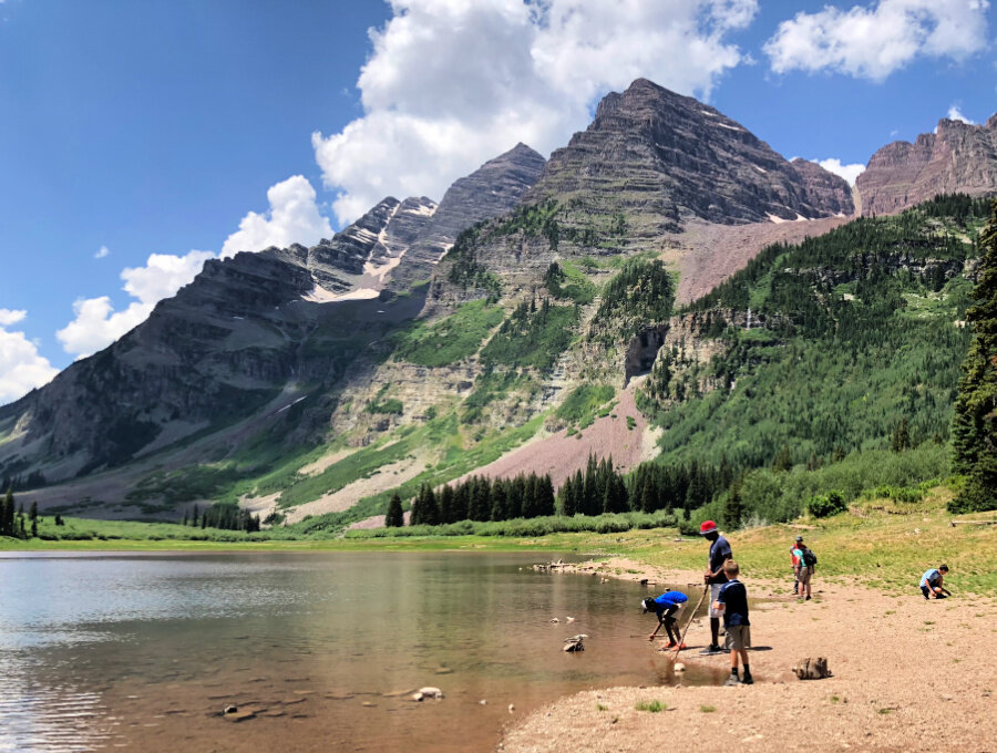
This Colorado hiking trail to Crater Lake is one of the best ways for hiking to Maroon Bells with kids.
Only 3.8 miles in length, round trip, you will climb 700 feet in elevation, so take your time and pack a picnic lunch in your day packs, along with lots of water.
One of the best hikes in Colorado is up to Crater Lake at the foot of the Maroon Bells near Aspen.
You will hike past Maroon Creek from Maroon Lake through aspen groves. Then you will show up to Crater Lake immediately below the Maroon Bells’ sheer eastern face.
Skipping rock contests and stepping into the edge of the lake are favorite past times here. Scan the area wildlife and keep a safe distance.
Pro Tip: Crater Lake often dries up by mid to late summer, after the snow melt is gone, but the Bells are still a sight to behold.
Stay overnight in one of these gorgeous condos in downtown Aspen near the chair lift and great restaurants and shopping.
Here are more hikes and tips for seeing the Maroon Bells in Aspen.
Looking for more cool lake hikes in Colorado? Tanya rounded up a bunch here: Spectacular Lake Hikes.
Blue Lakes Trail
When it comes to Colorado’s best hiking trails, head to Ouray for unforgettable scenery and adventures.
Million Dollar Highway is one of the most iconic and picturesque roads in Colorado and it’s also near some of the best Colorado hikes.
Hikers looking for killer views should check out the challenging Blue Lakes Trail in the Mount Sneffels Wilderness, located near Ridgway and Ouray and Telluride.
To reach the lower, middle, and upper Blue Lakes via the Blue Lakes Trail, you will climb 2,509’ up 11,720 feet and hike 8.7 miles.
At the top of the third Blue Lake, enjoy panoramic vistas as you enjoy some of the best views that Colorado has to offer! Outstanding views of Mt. Sneffels, as well as 13,809-foot Dallas Peak and 13,694-foot Gilpin Peak await you.
Hikes near Ouray and the MIllion Dollar Highway range from short strolls to more steep climbs which take you to breathtaking spots like old mines, alpine meadows, and narrow canyons with wildflowers.
We are dying to hike in the San Juan Mountains again this coming summer.
RELATED READING: A Stunning Southern Colorado Road Trip
Chief Ouray Mine and Upper Falls
For some of the best hiking in Colorado, head to Ouray in the San Juan Mountains.
Enjoy secluded, powerful falls and an old famous mine on this challenging 4.3 out and back hike leaves near our favorite Amphitheater Campground.
Check out our Ultimate Guide to Camping in Colorado.
Climb over 1800 feet in elevation to reach above 10,000 with a fantastic overlook of Ouray.
Not into this challenging hike? Head to Lower Cascade Falls, accessible right from the town of Ouray instead.
PRO TIP: Cascade Falls Park is the lower most of a series of seven waterfalls in Cascade Creek. The top waterfall in the series, Upper Cascade Falls if for more experienced hikers, while Lower Cascade Falls is easy for small children.
Learn more about all of our favorite hikes neary Ouray.
Crystal Lake near Breckenridge
The hike to Crystal Lake in Breckenridge is one of Colorado’s best hikes.
One of the top vacation destinations in Colorado is Summit County, where you can find some of the best hiking trails for all skill levels.
Breckenridge provides a variety of great hikes like Mohawk Lakes Trail, Spruce Creek Road Trail and Lost Lake Trail.
But we want to tell you about couple of hikes that may not be on other’s radars.
A Monberg family favorite, the tough, but rewarding, hike to Crystal Lake requires carrying A LOT of water and snacks to refuel. But you’ll also experience way fewer people than at Mohawk Lake.
While short in mileage (4.6 miles), know that you will climb you’ll ascend 2000 feet in elevation by the time you get to Upper Crystal Lake.
Summit County hiking trails aim to please and Melody is happy to tell you all about them.
Ptarmigan Trail
Breckenridge is a great base for some of the best hikes in Colorado.
Stunning in summer, Ptarmigan Trail is also near Breckenridge.
Mileage: 5 miles Elevation Gain: 1,141’ Route: Out and Back
Another hike perfect for families, this 5 mile out-and-back hike shows off wildflowers, lakes, and mountain views. While there are some burn scar areas, the trail meanders through aspen and conifers with views the entire way.
For the first 20-30 min, around 3/4 of a mile, expect a steep trek. Starting at just over 9,000 feet elevation, wear sunscreen and a hat as most of the trail is exposed.
Enjoy views of Dillon Reservoir. Then keep on hiking through aspens and pine trees.
Whichever Summit County hiking trails you choose, there are memories waiting to be made!
Stay in this beautiful Breckenridge townhome right on the mountain. In summer, follow the trail for a walk into town.
Mount Elbert
Mount Elbert is an ideal first fourteener in Colorado.
If you’re looking to bag an easy Class 1 Colorado fourteener, then head to Mt. Elbert.
Rising at 14,439 feet, there are five ways to reach this peak.
Mount Elbert is Colorado's highest peak and the second highest peak in the lower 48 states
We recommend hiking the South Mount Elbert Trail if you’re new to fourteeners.
Enjoy traversing switchbacks through a large aspen grove and pine forest during the first half of your hike.
Once you get above tree line, you'll spy an alpine lake and be treated to stunning Rocky Mountain 360 degree views.
Hiking to Mount Elbert is no joke for those coming from lower elevation and you will log a lot of miles. But the trail is well marked and older children have been known to make the trek.
Depending on where you are able to park your vehicle near the trailhead, you will hike 11.6 miles or more round trip.
Stay in nearby historic Leadville in this home with breathtaking mountain range sunsets and a birds-eye view of the town below!
Browns Creek Waterfall Trail
The hike to Browns Creek Waterfall is one of the best Colorado hiking trails near Buena Vista.
The trail leading to Browns Creek Waterfull is one of our top favorite hikes near Buena Vista Colorado.
You will hike 3 miles to this fantastic waterfall, and we’ve even done it in the winter. Iced over, you can still hear the water trickling under the icy falls.
A lot of the elevation gain is during the beginning of the hike. Be sure to turn around to catch views of the Arkansas River Valley.
You will also be treated to many views of Mt. Antero while you make your way to the falls.
Have fun crossing Browns Creek several times via small log bridges.
This waterfall hike is a perfect choice for a short moderate day hike and is well marked. Learn more about about all of favorite hikes and things to do in Buena Vista and Salida.
Base yourself and your crew in this fabulous scenic mountain home on Chalk Creek and just up the road from Mount Princeton Hot Springs.
Hanging Lake
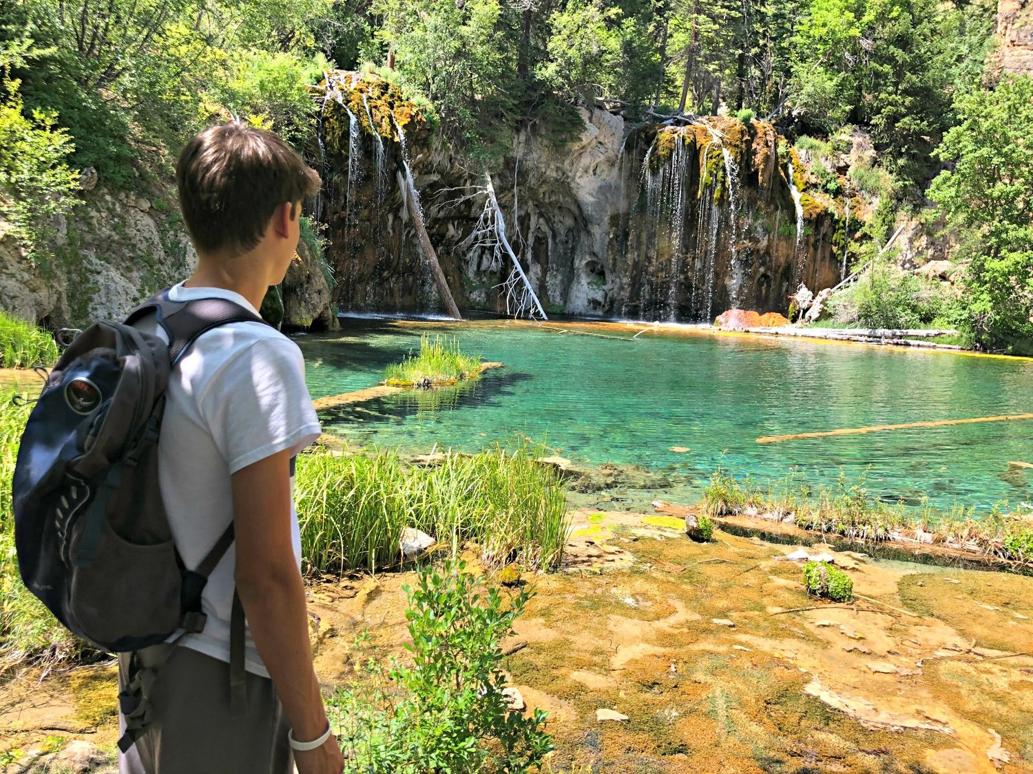
Hanging Lake is a top Colorado hiking trail that will get your heart racing.
HANGING LAKE TRAIL IS CLOSED for the winter due to continuing cosntruction and unsafe hiking conditions. The trail is estimated to reopen in late May or early June 2025. Check back for trail reopening dates.
The hike to Hanging Lake is a two for one!
Not only do you get to see Hanging Lake, a National Natural Landmark, be sure to hop on the short offshoot from the trail that leads to Spouting Rock - a tall, spectacular waterfall!
A short hike at just 3.1 miles round trip, it is very steep and rocky! Proper footwear is a must, and this trail is not ideal for small children or elderly.
Enjoy the scenic ascent from the bottom of Glenwood Canyon up through Deadhorse Creek Canyon to Hanging Lake. Plan well for this hike, as your cell phone will not have coverage and you should bring plenty of water to drink.
Learn more about hiking to Hanging Lake and soaking in hot springs in Glenwood Springs.
If you are staying nearby, consider checking out more cool Colorado waterfall hikes at Rifle State Park, just 45 minutes from Glenwood Springs.
We love these large family friendly vacation homes just minutes from downtown and Glenwood Springs Hot Springs.
Monument Canyon and Wedding Canyon
Fabulous intriguing trails in Grand Junction | Colorado National Monument
Some of the most interesting Colorado hiking trails are found near Grand Junction in Colorado National Monument.
Twenty-five hiking trails of varying length and difficulty offer lots of eye-candy in this often passed by national park.
Head out on a lollilop trail to Monument Canyon and Wedding Canyon. You will hike just over 7 miles and climb 961 feet total.
You’ll find yourself hiking across the canyon floor banked by large red rocks.
Beat the heat in the summer by heading out in the morning. This hike is most colorful at sunrise or just before sunset.
With view like no other place in Colorado, check out more hikes near Grand Junction and Colorado National Monument.
Dozens of fantastic Colorado hiking trails like this one in Grand Junction
Colorado Fourteeners and Thirteeners
Is there such a thing as an easy 14er to climb? Many of us dream of bagging a peak but how much time does it take? Which fourteener is the easiest? And do we need to train for it?
Here’s everything we know about how to get started hiking our favorite fourteeners.
Let's be honest, summiting a 14er or a 13er is not your average day hike for most people. It takes serious grit, determination, and physical training to make it to the top. But with the right mindset, gear, and preparation, hiking Colorado's fourteeners can be an unforgettable experience that will leave you feeling on top of the world.
If you want to know more about hiking all of the fourteeners in Colorado, head to 14ers.com.
With towering peaks, breathtaking vistas, and a sense of accomplishment like no other, conquering majestic 13ers in Colorado is a thrilling adventure.
Let’s Talk.
We’d love to help you plan your trip to Colorado! Pick our brains about hiking and camping all over this Rocky Mountain wonderland.
